


Purchase Tickets
Reflections on the Meaning of Statehood
December 12, 2018
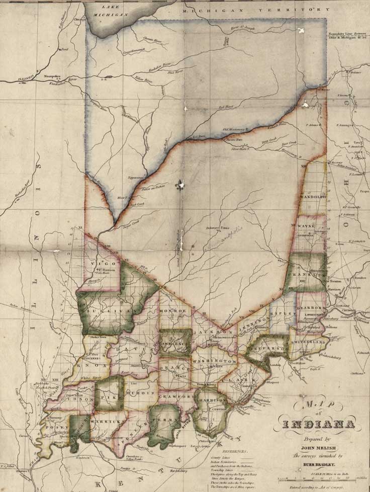
Dec. 11 was the 202nd anniversary of Indiana’s Statehood. On that day, we usually send out a “Happy Birthday” message. These posts on social media are lighthearted ways to recognize the day. One popular image in Statehood day posts is this 1819 map of Indiana. This map, prepared by John Melish, was originally published in 1817 and revised in 1819. It depicts the counties that were created before statehood and those that were founded in the following three years. This map also shows “Indian Boundaries and Purchases from the Indians.” Melish labeled the central portion of the state as “Delaware Towns.”
We can’t ignore that the people who were here before were violently and forcibly removed from their homes in order to form the state we now know as Indiana – “Land of the Indians.” The early people who settled in Indiana were river-centric and it was the Wabash where tribes such as the Miami made their homes. Around 1800, the tribes in the Indiana territory were: Wyandotte, Piankashaw, Shawnee, Delaware, Miami, Wea and Potawatomi. Over the next 40 years, most of the members of these tribes were pushed out of the territory and state. The symbolic cap to the white man’s western expansion was the Potawatomi Trail of Death in 1838.
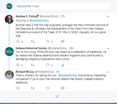
After posting the Melish map, this fact was pointed out. And I’d like to provide a little more context. It got me to search our digital collections. I came across this map, illustrating cessions of land by tribes in Indiana. In addition to the map, there’s a booklet published in 1881 to explain it titled Cessions of Land by Indian Tribes to the United States by C.C. Royce. It is an extract from the first annual report of the Bureau of Ethnology. If you want to jump straight to what the numbers on the map below mean, go to page 257. It’s vital to note that the cessions tribes made of land were the only option left to them.
Even using this source means that a caveat is necessary – it was written by a white man in the 1880s when the acceptable description of western migration was: “The unprecedentedly rapid increase and expansion of the white population of the country, bringing into action corresponding necessities for the acquisition and subjection of additional territory, have maintained a constant struggle between civilization and barbarism.” Nevertheless, it does provide a jumping off point to discover how Indiana became Indiana.
The ramifications of how the white population treated the indigenous populations from the pre-Colonial era and on are still felt today. In October, we hosted a discussion called Let’s Talk: Indigenous Peoples. Read about five highlights one of our staffers learned.
These are complex issues; issues that I’m not an expert in. There really cannot be a defense of the way European settlers treated the indigenous populations of what came to be the United States. It is a dark period in our history that we must learn about and learn from. To that end, when we talk about Statehood Day, let’s remember that this birthday of sorts wasn’t and isn’t only about celebration but remembrance as well. One of my coworkers recently participated in an American Association for State and Local History webinar on Native American activism and shared this from one of the speakers, Philip Deloria, Harvard University professor and member of the Dakota Nation, that says it all: “You’re not responsible for the history, but you are responsible to the history.”
Further Reading and Helpful Sources
*These are all sources I had close at hand. It is not meant as an exhaustive list.
Mapping Indiana: Five Centuries of Treasures from the Indiana Historical Society, Donald Cresswell, Nicole Etcheson, Erin Kirchhoff, Eric L. Mundell and Amy Vedra, IHS Press, 2015 (see page 80 for an essay about the Melish map discussed above)
Hoosiers and the American Story, James H. Madison and Lee Ann Sandweiss, IHS Press, 2014 (see page 9 for a map of Native American tribes in Indiana in 1800, textbook geared toward 8th grade through 12th grade)
Hoosiers a New History of Indiana, James H. Madison, IU Press and IHS Press, 2014
Bones on the Ground, Elizabeth O’Maley, IHS Press, 2014 (young adult historical fiction based on actual events)
Murder in Their Hearts: The Fall Creek Massacre, David Thomas Murphy, IHS Press, 2010
The Native Americans, Elizabeth Glenn and Stewart Rafert, IHS Press, 2009
Two-Moon Journey: The Potawatomi Trail of Death, Peggy King Anderson, IHS Press, 2018
William Henry Harrison Papers and Documents, 1791–1864, Indiana Historical Society digital collections
Cessions of Land by Indian Tribes to the United States: Illustrated by those in the State of Indiana, map, Indiana Historical Society digital image collection, 1881
Cessions of Land by Indian Tribes to the United States: Illustrated by those in the State of Indiana, extract, Indiana Historical Society digital image collection