


Purchase Tickets
From the Cataloger’s Desk: My New Favorite Map
November 26, 2018
I have been making a conscious effort to catalog more maps recently. I hate to admit it, but I sometimes neglect my duties when it comes to printed materials that aren’t books or pamphlets. For the most part, it is a simple case of “out of sight, out of mind.” Maps waiting to be cataloged are stored in flat files outside of my office, and I don’t always remember to check them. It’s a poor excuse, I know. I am determined to do better, though, because I truly enjoy working with maps. They present a unique set of challenges, so when I am able to successfully add new map records to the catalog, I feel rather victorious.
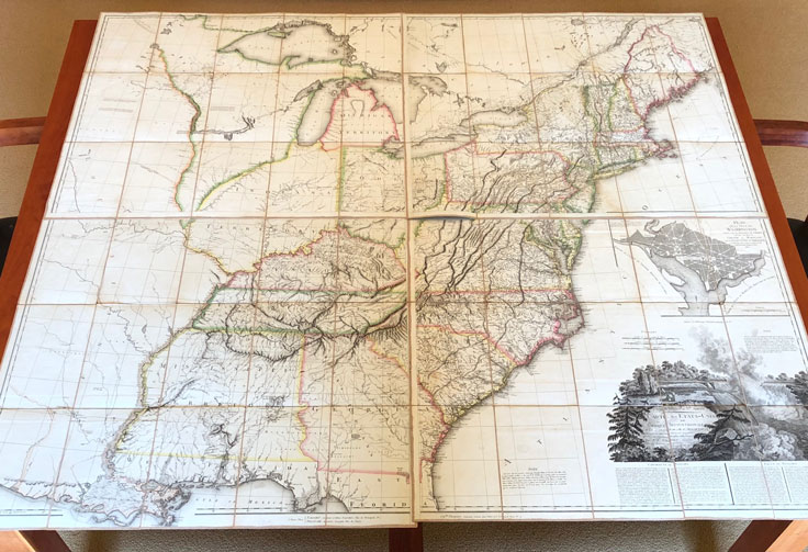
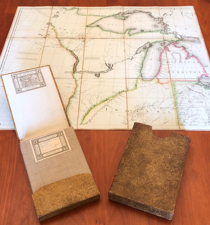
In the last few months, I have cataloged a wide variety of maps: state maps, county maps, city maps, highway maps, railroad maps, and geological maps. Most, of course, are Indiana-related, and all are interesting in their own right. I was completely floored, however, when I discovered P.F. Tardieu’s 1808 map, United States of Nth. America: carte des Etats-Unis de l’Amérique Septentrionale. Comprising four individual linen-backed sheets, it came my way via a simple slipcase. In other words, it looked like a book at first glance. As I carefully removed, unfolded, and assembled the sheets for the first time, I was completely awestruck.
 In terms of total size, the map is quite large, measuring in at approximately 122 x 142 centimeters, or 4 x 4.5 feet. It is hand-colored, making the borders of states and territories very clear. What impresses me most is how accurate the cartographer’s work is. After all, this map was made over 200 years ago, without the benefit of modern-day tools or technology, and before much of the land had been fully explored. The Indiana Territory is practically a large, blank slate. If you look closely, however, you will see some familiar names, such as “Vincennes” (the capital of the Territory at that time), “F. Wayne,” and “River Wabash.”
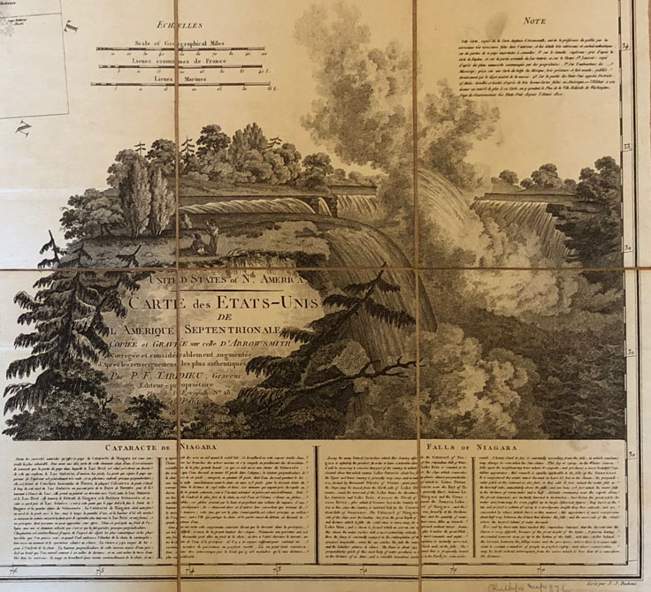
As if the map itself wasn’t enough, there is a detailed inset plan for the city of Washington with the “Capitol,” “Palais du Président,” and “George Town” clearly labeled. There is also a breathtaking illustration of the “Falls of Niagara” with an accompanying description in both French and English. There is just so much to discover and appreciate in this very unique work, I could go on, and on, and on. Instead, I encourage you to see it in person, as the photos in this post hardly do justice to its beauty and grand scale. It is a real treasure in our collection, and I hope you love it as much as I do!
 The catalog record for this item can be found here.