


Purchase Tickets
From the Cataloger’s Desk: A Pocket Map of Indiana
February 7, 2018
This month, I am switching gears a little bit. I catalog maps on a somewhat regular basis, but not nearly as often as I catalog books and pamphlets. I have yet to blog about a map, and since I just cataloged an especially interesting one, I figure now is the perfect time!
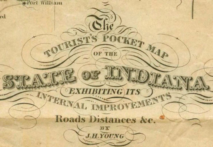
 This is the IHS library’s second copy of The Tourist’s Pocket Map of the State of Indiana, Exhibiting its Internal Improvements, Roads, Distances &c., published in 1837. It is beautifully hand colored and shows various aspects of the state as it was almost 200 years ago, including: counties, towns, railroads, stage roads, and waterways. It also provides information on steamboat routes from Louisville to New Orleans, Louisville to Pittsburgh, the Ohio River to Lafayette, and the Ohio River to Indianapolis.
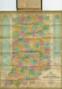
 Indiana counties are listed alongside the map with population sizes based on the 1830 census. Of course, not all 92 counties are included, as some did not exist at the time. The numbers are truly fascinating. According to data on the map, Wayne County had the highest population at the time (18,571), and St. Joseph County had the smallest (287). Today, estimates rank Wayne County as having the 25th highest population in the state, but St. Joseph County has climbed all the way up to 5th place. What a difference!
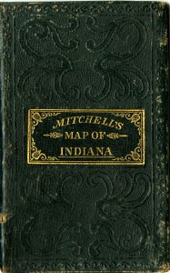
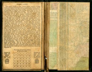
 My favorite thing about this map – aside from the valuable information it offers – is the way it is presented. At first glance, it looks like a tiny book. Closer examination reveals it to be a pocket map, which is the perfect size for any traveler. An explanation of how U.S. public lands were acquired and divided is pasted onto the inside front cover. The map itself is folded down, and since the paper is quite delicate, unfolding it requires care and patience. Once it is open, one can’t help but appreciate the beautiful colors and obvious skill of the mapmaker. As I said before, this is our second copy of the map. It is interesting to compare the two side-by-side. The first copy is in better shape, but perhaps that is because the second copy was used more often. Whatever the case may be, I invite you to the library to look at one – or both – of them!
The catalog record for this item can be found here.