Purchase Tickets
Living the Legacy: Our Upcoming Sept. 29 Redlining Program
September 28, 2020

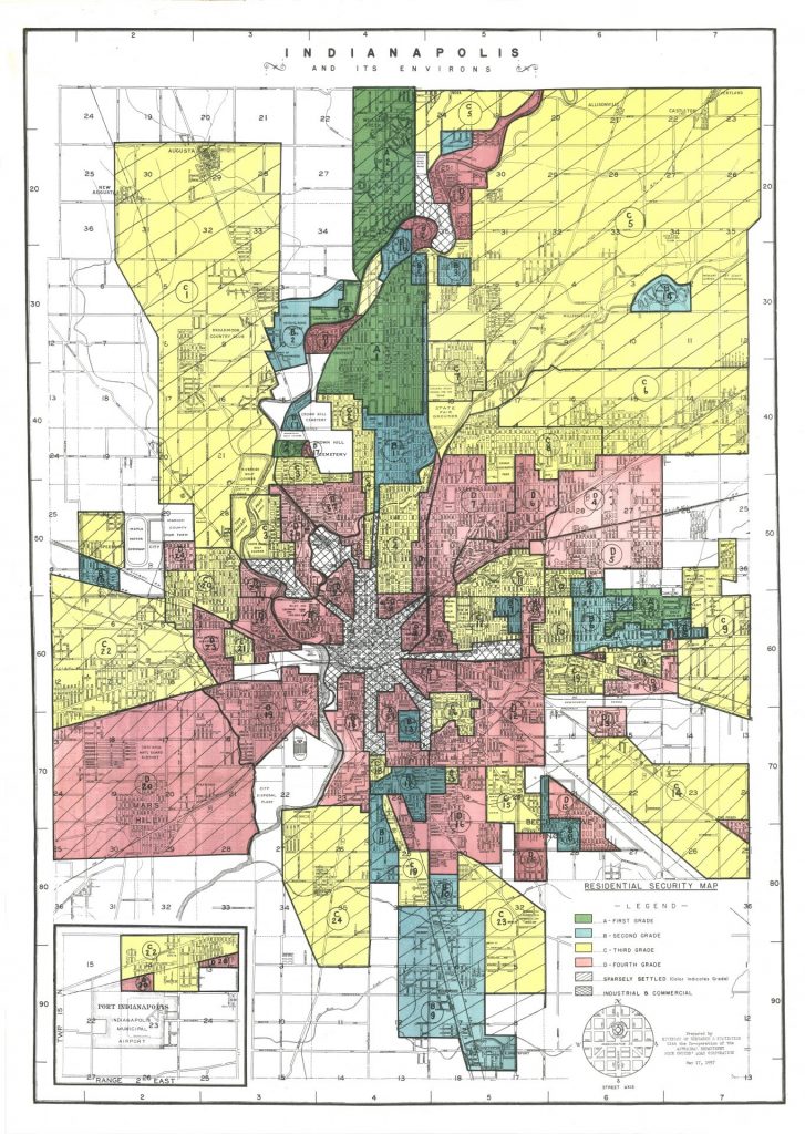
We’ve kicked off our new Indianapolis bicentennial exhibit, You Are There 1920: Celebrate Indianapolis with a four-part program series on the history of redlining. Redlining is the discriminatory practice in which banks, mortgage lenders, and insurance companies refused or limited loans, mortgages, and insurance within specific geographic areas, particularly in older and city center neighborhoods, to Black and/or low-income families. This policy was guided by the Federal Housing Administration’s Home Owners Loan Corporation in the 1930s. Reasons for HOLC devaluation, aka “being redlined,” included the race or nationality of the resident, the type, age, and materiality of the residence, market versus rental values and other assessment trends, and even proximity to things such as floodplains or heavy industry.

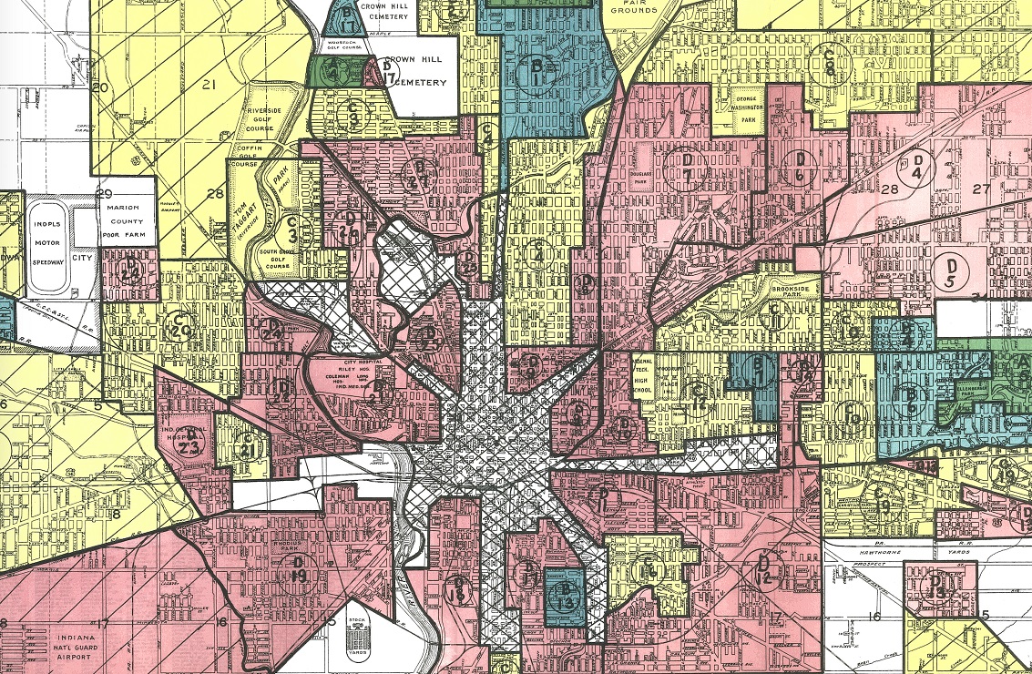
This map depicts the HOLC valuations for Indianapolis in 1937. Citation: Robert K. Nelson, LaDale Winling, Richard Marciano, Nathan Connolly, et al., “Mapping Inequality,” American Panorama, ed. Robert K. Nelson and Edward L. Ayers, accessed September 28, 2020, https://dsl.richmond.edu/panorama/redlining.
Roughly 150 cities were surveyed between 1935-1940 across the U.S., including Indianapolis in 1937. Looking at the interactive map available online from the digital public history project, Mapping Inequality, one can explore the HOLC valuations for the city boundaries at the time. There are four grades, green being the best, blue was “still desirable,” yellow was “definitely declining,” and red was “hazardous.” Along with the map, one can view the “Area Description” forms that informed these valuations. Historians, city planners, service organizations, and community development groups trace today’s inequities between neighborhoods and communities in part as a consequence of redlining.

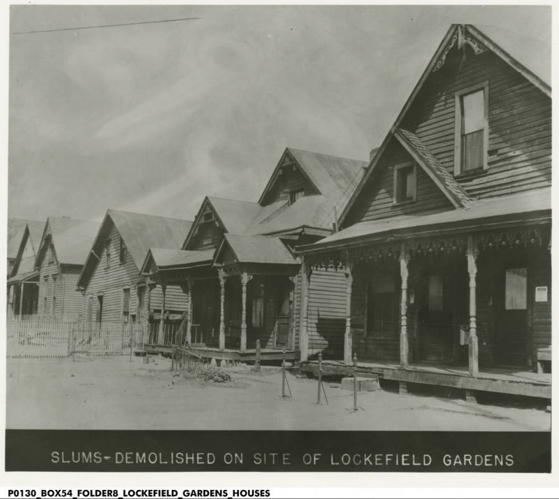
This is a photograph of demolished vernacular cottages on the 900 block of West North Street was located in HOLC’s section D-21, which was redlined. Bass Photo Co Collection, Indiana Historical Society
The first program in the series, “Rethinking Redlining & Segregation: Prologue to the Covid-19 Crisis,” featured Dr. N.D.B. Connolly, the Herbert Baxter Adams Associate Professor of History at Johns Hopkins University and author of A World More Concrete: Real Estate and the Remaking of Jim Crow South Florida. You can watch the program here.

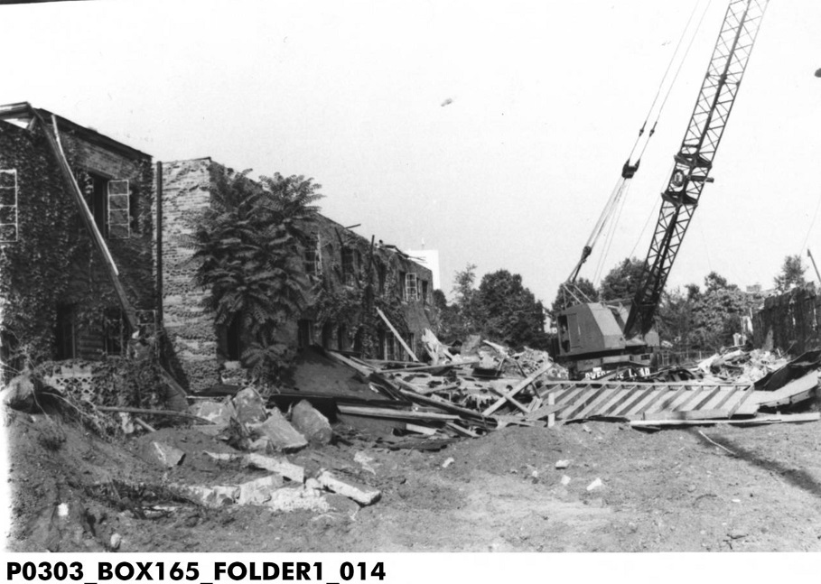
Section D-21 would soon become the site of Lockefield Gardens, the first public housing provided in Indianapolis. While the “Area Description” form mentions Lockefield Gardens in the clarifying remarks section as a promising development, not even 50 years later IUPUI demolished half the structures to expand and reconfigure a street. Indianapolis Recorder Collection, Indiana Historical Society
Please join us tomorrow, Tuesday, Sept. 29, for the second program in the series, “Living the Legacy: Making it Local” where our panel of experts will describe what redlining looked like in Indianapolis and the impact the policy had on local communities. This program is free thanks to funding made possible through a grant from Indiana Humanities, in cooperation with the National Endowment for the Humanities, and from The Indianapolis Foundation, a CICF affiliate. Register for the zoom link and read more about the upcoming programs “Developing the City” on 10/27 and “Creating Equity Today” on 11/10 here.


